Your Shopping Cart is empty.


Download sample
File Details
Published: 2022-02-08 20:18:05.504639 Category: Graphic Resources Type: Illustration Model release: No
Share
       

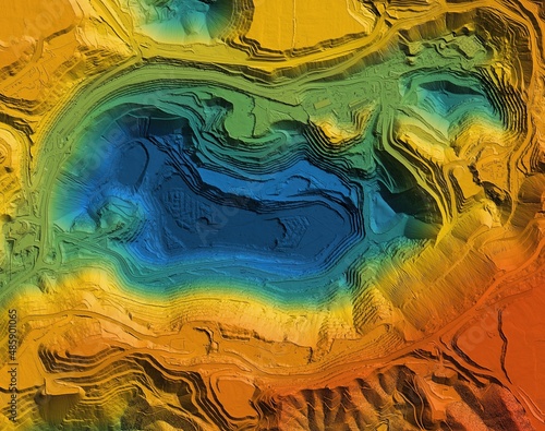
Digital elevation model. GIS product made after proccesing aerial pictures. It shows excavation site with steep rock walls that was mapped from a drone

Contributor: Ungrim
ID : 485901065

TitleFilesize
Illustration5271x4159


Buy on Adobe Stock

Keywords
quarry, cartography, us, us, excavate, construction, engineer, development, drone, elevation, excavation, engineering, shoveling, geodesy, geology, graphic, hole, industrial, industry, inspection, investigation, land, map, mine, model, topography, terrain, professional, rock, site, survey, surveying, technology, topographic, transportation